Pioneering the Use of Drones for Roof Inspections and Thermal Imaging
Before the widespread use of drones, facade inspections and roof inspections were performed by climbing the exterior wall or dropping down a scaffold from the top of a building.
Roofs can be particularly dangerous to inspect because they have a variety of elevations which require that an inspector climb multiple areas, quickly adding both time and cost to the project. Scaling buildings becomes even more involved when the architecture is complex, such as when inspecting houses with various nooks and crannies.
Before the adoption of drones, detailed inspections were virtually impossible. As a result, large amounts of unobservable building facade were merely unseen.
Even if the exterior of a building looked okay, there could still be moisture present, causing hidden damage.
The use of drones for building inspections is comparable and, in many respects, better than traditional methods of surveying a building. The quality of photographic images captured by drones makes using drones for property inspections a worthy choice. Using high-resolution photographic techniques, a building inspector or engineer can see the existing conditions through a detailed inspection in their office, rather than facing challenging conditions when performing a site inspection outdoors. Furthermore, drones can reach places and locations that were previously unreachable, gathering data and providing high-quality images for later analysis.
Drones can also use different technologies to create 3D models of a building or space, and point-cloud technology allows the images to be stitched together to create a 3D object or space.
CTL and Drones
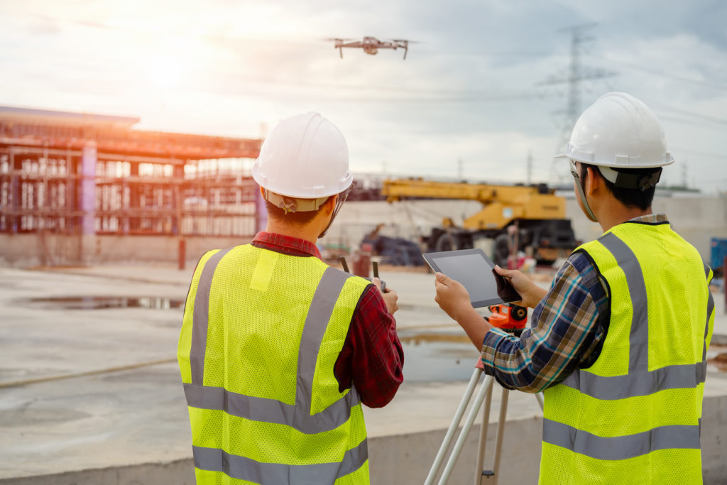
Today, CTL Engineering, Inc. is achieving new heights using Unmanned Aerial Vehicle (UAV) technology, also known as drones. This multifaceted technology allows CTL Engineering’s clients to complete projects quickly, safely, effectively, and in a cost-efficient manner. By using drone technology as opposed to more traditional methods, CTL can perform surveys in a fraction of the time, conduct inspections more safely, and save clients tens of thousands of dollars in surveying costs alone.
Using Drones for Exterior Inspections of High-Rise Buildings and Thermal Imaging of Roofs
CTL Engineering has unparalleled knowledge and historical experience within the areas of exterior inspections of high-rise buildings and thermal imaging of roofs.
Using Drones for Exterior Inspections
Manual inspections of roofs are no longer needed to pinpoint the location of any issues that need to be addressed. During an exterior inspection, a drone is flown in a predefined pattern, capturing images of every inch of the structure. These images are analyzed by an engineer, site manager, or building inspector who is safely located in an office. This allows for a more detailed analysis that could be completed by an inspector in the field.
Additionally, the images provide a record for the owner of the building, documenting the state of the structure at the time of inspection. This provides an invaluable resource for insurance purposes, and for a comparative analysis in the future.
The structure location is accurately documented using photographs taken by the drone. Each photograph includes a GPS location as part of the metadata. This information is particularly useful when photographing large spaces. Problem areas can then be easily identified by someone well-oriented with the project viewing surrounding features in the photographs.
In fact, CTL Engineering performed a building envelope inspection using drone technology for city-required Critical Observation Reports (CORs) on two iconic buildings in downtown Columbus: the James A. Rhodes State Office Tower, a 41-story, 629 foot building recognized as the tallest building in Columbus, and the Leveque Tower, a 47-story, 555.5 historic, Art-Deco skyscraper listed as the 5th tallest building in the world when completed in 1927. In both cases, CTL Engineering was able to identify areas of structural and aesthetic concern.
Drones for Thermal Imaging of Roofs
When performing thermal imaging of roofs using drone technology, thermal images are gathered using a specific lens attached to the drone that can be used to capture infrared data.
This type of thermal imaging can be used to detect areas of heat loss, moisture in the insulation, and locations of potential roof leaks.
Thermal cameras are a powerful tool when conducting roof inspections. Wet areas of a roof retain heat longer than dry ones. Once the sun goes down and a roof begins to cool, thermal imagery can be used to detect these temperature differences and help inspectors pinpoint areas of concern that warrant a closer look.
By remotely identifying problem areas in real-time, inspectors can focus their work and limit on-the-roof time to only those areas of concern. This ultimately reduces inspection time and, therefore, cost to the client.
CTL Engineering recently conducted a drone survey on the 1.8 million square foot roof of the Greater Columbus Convention Center to identify water infiltration into the aging PVC roof. This survey was performed using an infrared camera attached to a drone which was used to identify areas of the roof that were holding water. These areas were then marked for further inspection, and the data was reviewed by CTL’s in-house Certified Roofing Consultant.
Drones Offer Safe, Cost-Effective, Efficient Tool for Building Inspections
Additional applications of drone technology including surveying, 3D modeling, infrared inspections, business marketing, and much more. CTL continues to lead the way in drone innovation and its use for various engineering projects.

